Last updated:
📍262 Bogungmun-ro, Seongbuk-gu, Seoul | 서울특별시 성북구 보국문로 262
🚆 Gupabal Station Line 3, Exit 1
🕒 Summer Season (Apr.-Oct.) 4:00 – 17:00 / Winter Season (Nov.-Mar.) 4:00 – 16:00 (Hiking at night is forbidden.)
₩ Free
🌐 www.knps.or.kr/bukhan | www.seoulhiking.or.kr
☎️ +82-2-909-0497
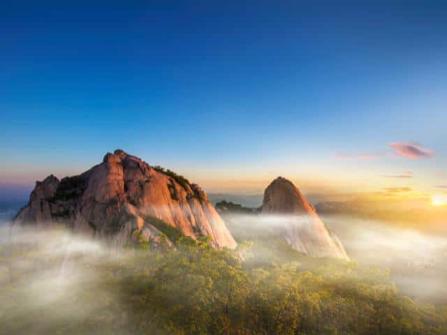
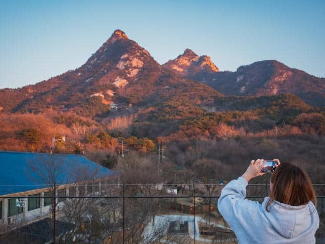
If you’re planning a trip to Seoul, Bukhansan National Park is worth a visit. This is a heaven for nature enthusiasts, hikers, and adventurers alike. With its towering granite peaks, lush forests, and scenic trails, it offers a perfect escape from the hustle and bustle of city life. Here’s everything you need to know to make the most of your trip to this beautiful park. Ready to explore? Let’s go!
About Bukhansan National Park
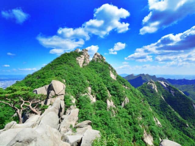
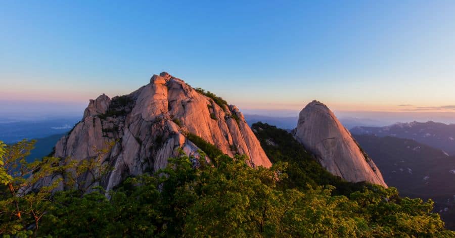
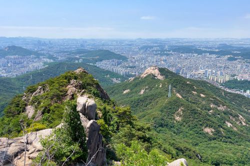
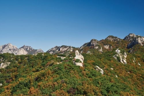
Bukhansan National Park is a stunning mountain range in the heart of Seoul, South Korea. Established in 1983, it covers an area of 80.69 square kilometers and is known for its forested areas, granite peaks, historical sites, and temples.
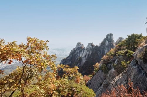
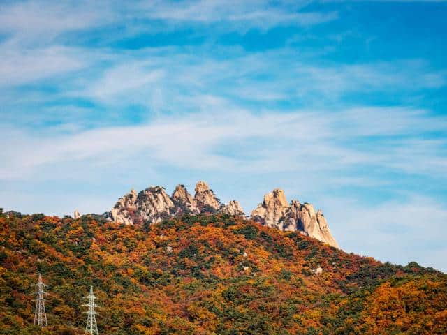
The park is the top destination for hikers both locally and internationally. It offers a variety of trails to suit all levels of hikers, from beginner-friendly paths to challenging climbs. The trails lead to several peaks, including the three main ones: Baekundae Peak 백운대 (836.5 meters), Insubong Peak 인수봉 (810.5 meters), and Mangyeongdae Peak 만경대 (799.5 meters).
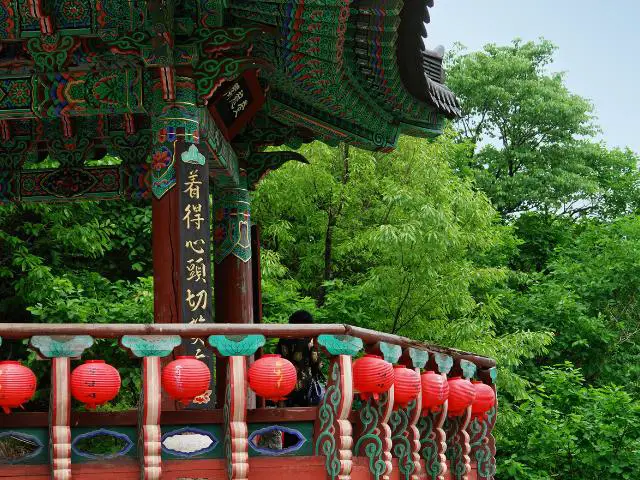
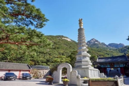
Moreover, the park boasts the Bukhansanseong Fortress, a massive defensive wall built in 132 AD to protect Seoul from invasions. Several Buddhist temples are scattered throughout the park, offering a peaceful escape from the city.
How to get to Bukhansan National Park
There are 3 popular entry points to Bukhansan National Park.
Bukhansanseong Park Information Center 북한산성탐방지원센터
This is the main entrance to access the highest point of Baegundae Peak and embark on a picturesque valley and main road loop trail.
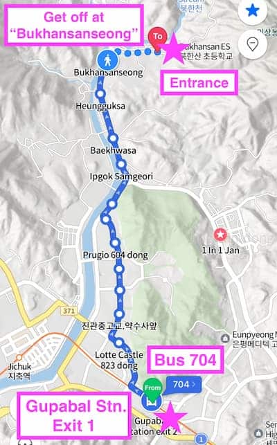
- Start at Gupabal Station (구파발역), exit 1 on line 3. Upon exiting, make a U-turn and proceed about 20 meters to reach the bus stop.
- Take Bus 34/704/8772 which will take you to the Bukhansanseong (Fortress) (북한산성) bus stop, approximately a 17-minute ride. English announcements are provided on the bus.
- Upon getting off the bus, continue walking in the same direction as the bus. At the first junction, turn right and follow the road until you reach the Bukhansanseong Park Information Center, which marks the entrance to the park.
Jeongneung Park Information Center 정릉탐방지원센터
This is the best choice for an easy experience to enjoy the beauty of Bukhansan’s nature.
- Start at Gireum Station (길음역), exit 3 on line 4.
- Take Bus 110B or 143 and ride until the last stop, approximately a 13-minute journey.
- From the bus stop, stroll up the gentle slope for about 10 minutes until you reach the park entrance. Then, you’ll find Jeongneung Park Information Center.
Dobong Park Information Center 도봉탐방지원센터
If you want direct subway access, this route of Jaunbong Peak/Uiam Rock is great.
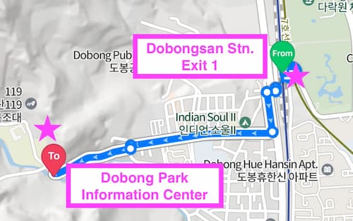
- Start at Dobongsan Station (도봉산역) on line 1/7, taking exit 1.
- Cross the road at the traffic light immediately after exiting the station.
- Follow the local hikers to the park entrance, which takes about 20 minutes. Along the way, you’ll pass numerous food stalls and hiking shops.
Check out our post on Transportation in Seoul for easy traveling.

Hiking trails at Bukhansan National Park
Advanced trails at Bukhansan National Park
Course 1: Baegundae– Ui Gugok Trail (most popular trail)
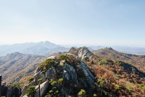
This path is the shortest way up to Baegundae Peak, the top of Bukhansan. The part from Haroojae Pass to Yeongbong Peak is steep. Once you reach Yeongbong Peak at 604 meters, you’ll see the impressive rock face of Insubong Peak. And when you finally reach the summit at 836.5 meters, you’ll get a fantastic all-around view of Seoul.
General information
- Route: Seoul Hiking Tourism Center(Bukhansan) → Chanunbong Peak → Baegun Visitor Center → Haroojae Pass → Yeongbong Peak → Haroojae Pass → Baegundae Peak → Yongammun Gate → Doseonsa Temple → Seoul Hiking Tourism Center (Bukhansan)
- Total travel distance: 9.98 km
- Average travel time: 4 hours 20 minutes
- Difficulty: Advanced
- Transportation: Once you get off at Bukhansan Ui (Doseonsa) Station, take Exit 2. The Seoul Hiking Tourism Center (Bukhansan) is just five minutes away.
Main spots
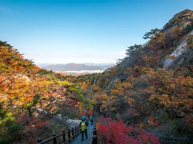
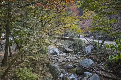
- Ui Gugok is one of nine beautiful spots in the Ui-dong valley. The scenery here is like something out of a fairy tale: tall granite cliffs with jagged rocks and scattered stones surround it.
- Yeongbong Peak: This peak is 604 meters above sea level. It’s a straightforward hike suitable for beginners. Yeongbong Peak is opposite Insubong Peak, a popular destination for rock climbing enthusiasts.
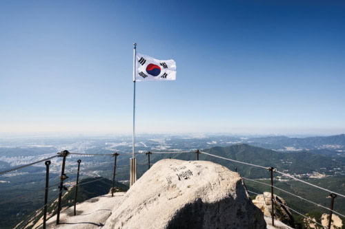
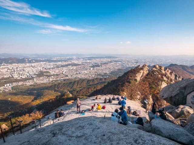
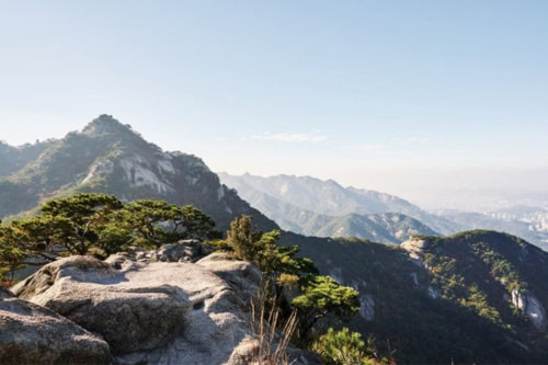
- Baegundae Peak: This is the summit of Bukhansan, reaching 836.5 meters in height. Insubong Peak is to the north, and Mangyeongdae Peak is to the south. Climbers at Baegundae Peak get a clear view of all the other peaks in Bukhansan. Below, you can see Seoul’s city center, with clear blue skies.
Course 2: Bukhansanseong–Daenammun Trail (most popular trail)
If you’re after a trail with breathtaking scenery and a dose of history, you’ve found it. This particular route is a hit among hikers, especially among visitors from abroad. It takes you past the main castle of Bukhansanseong Fortress and other historical palace sites. And with wildflowers blooming along the trail throughout the year, it’s even more picturesque.
General information
- Route: Bukhansanseong Visitor Center → Daeseomun Gate → Muryangsa Temple → Bukhandong History Museum → Daedongsa Temple → Baegunbongammun Gate → Mangyeongdae Peak → Nojeokbong Peak → Site of Jungheungsa Temple → Site of Haenggung → Site of Eoyeongcheong → Daenammun Gate → Gugi Valley → Gugi Visitor Center
- Total travel distance: 10.2 km
- Average travel time: 4 hours 10 minutes
- Difficulty: Advanced
- Transportation: From Exit 2 of Gupabal Station on Seoul Metro Line 3, take bus No. 704. Get off at the entrance of Bukhansanseong Fortress. The Bukhansanseong Visitor Center is only about 700 meters away up the road.

Main spots
- Site of Jungheungsa Temple: The former site of Jungheungsa Temple sits at the southern base of Nojeokbong Peak, between Janggunbong and Guambong peaks. Though the original temple was lost to fire in 1894 and later to flooding in 1915, it is currently undergoing restoration. Some surviving artifacts, including a temple bell from 1103 and a Buddhist incense holder from 1344, are used in the temple’s sanctum.
- Site of Haenggung: After the Japanese and Qing invasions in 1592 and 1636, King Sukjong beefed up the capital’s defenses with Bukhansanseong Fortress. A temporary palace, called “haenggung,” was set up at the base of Sangwonbong Peak.
- Daenammun Gate: Daenammun, one of the gates of Bukhansanseong Fortress, serves as a hub connecting all the main spots within Bukhansan Mountain. It links to Baegundae Peak, Haroojae Pass, Yeongbong Peak in the north, and Bibong Peak in the west. To the south, Gugi Valley leads to Kalbawi Ridge in the east. Hikers often enjoy the roundtrip hike from the valley to the gate.
Course 3: Samobawi–Bibong Trail (most popular trail)
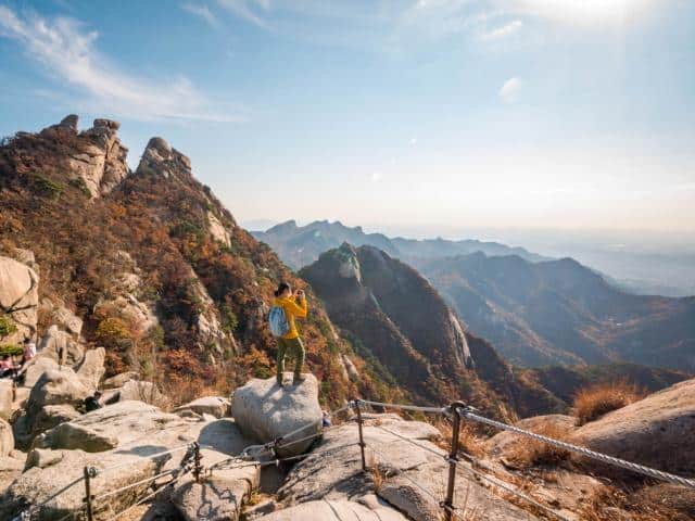
This trail is great for enjoying clear mountain streams and blue skies. You’ll find a monument marking King Jinheung’s border inspection of the ancient Silla Kingdom, and you’ll also pass the path taken by North Korean commandos in 1968. At the top, you’ll get an awesome panoramic view.

General information
- Route: Gugi Visitor Center → Seungasa Temple → Stone Seated Statue of Buddhist Monk Seungga → Rock-carved Seated Buddha → Samobawi Rock → Bibong Peak → Monument on Bukhansan Mountain Commemorating the Border Inspection by King Jinheung (Bibong Peak) → Geumsunsa Temple → Bibong Visitor Center
- Total travel distance: 6 km
- Average travel time: 3 hours
- Difficulty: Advanced
- Transportation: Ride bus No. 7212 from the bus stop opposite Exit 2 of Bulgwang Station, Seoul Metro Line 3. Alight at the Seungasa entrance, then cross the street at Lycee International Xavier. From there, stroll up Bibong-gil Street. You’ll find the Gugi Visitor Center around 800 meters.
Main spots
- Seungasa Temple: This temple, named after the Indian monk Seungga (Sengqie), is halfway up the mountain, approximately 1 kilometer east of Bibong. It boasts beautiful Buddhist temples, including one carved out of rock, and holds a stunning Golden Buddha.
- Bibong Peak: Bibong, meaning “monument peak,” sits at 560 meters. While it’s lower than Baegundae Peak, its views are just as impressive. At the top, you’ll find a replica of the Monument on Bukhansan Mountain, honoring King Jinheung’s border inspection.
- Geumsunsa Temple: Geumsunsa is a 600-year-old Korean Buddhist temple located in the beautiful surroundings of Mt. Bukhansan. After passing the double-centenarian pine tree and climbing the 108 steps, you will find the Daejeokgwangjeon Hall, home to the Vairocana Buddha. Geumsunsa is also famous for temple stays.
Course 4: Complete Tour of 12 Bukhansanseong Gates
As its name suggests, this trail takes you through all 12 Bukhansanseong Gates, comprising 5 primary and 7 hidden gates. While traversing these gates can be exhausting, the rewarding view at the summit makes it worthwhile. You’ll be treated to magnificent views of the Bukhansan scenery from the ridge line.
General information
- Route: Bukhansanseong Visitor Center → Uisangbong Peak → Gasadangammun Gate (Gate 1) → Yongchulbong Peak → Yonghyeolbong Peak → Jeungchwibong Peak → Buwangdongammun Gate (Gate 2) → Nahanbong Peak → Cheongsudongammun Gate (Gate 3) → Munsubong Peak → Daenammun Gate (Gate 4) → Daeseongmun Gate (Gate 5) → Bogukmun Gate (Gate 6) → Daedongmun Gate (Gate 7) → Dongjangdae Post → Yongammun Gate (Gate 8) → Nojeokbong Peak → Wimun Gate (Gate 9) → Daedongsa Temple → Bukmun Gate (Gate 10) → Saemaeulgyo Bridge → Jungseongmun Gate (Gate 11) → Daeseomun Gate (Gate 12) → Entrance to Bukhansanseong Fortress
- Total travel distance: 14.4 km
- Average travel time: 6 hours
- Difficulty: Advanced
- Transportation: From Exit 2 of Gupabal Station on Seoul Metro Line 3, take bus No. 704 to the entrance of Bukhansanseong Fortress. The Bukhansanseong Visitor Center is only about 700 meters away up the road.
Main spots
- Buwangdongammun Gate: This hidden gate, part of Bukhansanseong since 1711, strategically linked the Samcheonsa and Jungheungsa temples. It was crucial in transporting weapons, food, and reinforcements into the fortress during emergencies.
- Munsubong Peak: This peak marks the end of Uisang Ridge and is named after Munsusa Temple from the Goryeo Dynasty. Legend has it that praying on the toad-shaped boulder at the peak’s tip brings the blessing of a son.
- Dongjangdae Post: At Dongjangdae’s summit, you’ll see the entire Bukhansanseong ridges. This was a command post for Joseon Dynasty generals. The paths below, from Bogukmun Gate to Yongammun Gate, offer a mix of dirt and forest trails, with Dongjangdae in between. It’s a perfect spot for a quick break.
Course 5: Dobongsan Main Ridge Trail
This trail lets you uncover hidden beauty amidst Dobongsan’s ridges. Beginning with a gentle incline near Mangwolsa Temple, the slope gradually steepens as you ascend. However, reaching the summit is worth it because you’ll be treated to some seriously amazing panoramic views and the peaceful charm of valleys and streams tucked away between the ridges.
General information
- Route: Mangwolsa Station → Wondobong Valley → Mangwolsa Temple → Podae Ridge → Podae Observatory → Sinseondae Peak → Podae Observatory → Darak Ridge → Eunseogam Hermitage → Dobong Visitor Center
- Total travel distance: 9.32 km
- Average travel time: 6 hours
- Difficulty: Advanced
- Transportation: From Exit 3, exit Mangwolsa Station, Seoul Metro Line 1. Walk along the path to the right for approximately 20 minutes until you arrive at the Wondobong Visitor Center. From there, begin your hike toward Wondobong Valley.
Main spots
- Wondobong Valley: This valley extends from Jaunbong Peak, guiding you through Mangwolsa Temple, Deokje Spring, and Ssangyongsa Temple to the Wondobong Visitor Center. Between Ssangyongsa and the spring, you’ll spot Dukkeobibawi, a boulder said to look like a toad’s head.
- Mangwolsa Temple: This temple was built in 639 and derives its name from “mangwol,” meaning “to gaze at the moon.” When you visit, you’ll spot a rabbit-shaped boulder to the east of the Daeungjeon Hall, facing a moon-shaped boulder to the west.


Average trails at Bukhansan National Park
Course 6: Samcheonsa Trail
Look no further if you’re after a peaceful trail steeped in history. This route is perfect because it starts and ends at Buddhist temples, both over 1,000 years old. Samcheonsa, founded in 661 during the Silla period, and Jingwansa, established in 1011 during the Goryeo period, mark the beginning and end of the trail. As you hike, you’ll come across Seungabong Peak, named after the Seungasa Temple below. These ancient temples provide hikers with a serene retreat.
General information
- Route: Samcheon Visitor Center → Samcheonsa Temple (Rock- carved Standing Buddha) → Seungabong Peak → Samobawi Rock → Jingwansa Temple
- Total travel distance: 7.33 km
- Average travel time: 2 hours 40 minutes
- Difficulty: Average
- Transportation: Take bus No. 7723 from the bus stop behind Exit 3 of Gupabal Station, Seoul Metro Line 3. After seven stops, get off at Hana High School. Then, head right towards Samcheonsa. The Samcheon Visitor Center is about a nine-minute walk from there.
Main spots
- Samcheonsa Temple: Established by the Silla monk Wonhyo in 661, this temple is named after a legend claiming it once accommodated over 3,000 practicing monks (samcheon means 3,000 in Korean). Behind the Daeungjeon Hall stands a large boulder with an ancient standing Sakyamuni Buddha statue. The temple also features many historic paintings and sculptures.
- Seungabong Peak: This rising 567-meter-high peak is between Samobawi Rock and Munsubong Peak on Bibong Ridge. To the east, you’ll find Baegundae, Insubong, Munsubong, and Bohyeonbong peaks, and to the west are Samobawi Rock and Bibong. Its mesmerizing view attracts many photographers.
- Jingwansa Temple: Jingwansa Temple, a thousand years old, is one of Seoul’s four great temples. It’s renowned for its traditional Korean temple food and offers a popular temple stay program with an alms bowl meal, attracting tourists seeking purification.
Course 7: Dobongsan–Sinseondae Trail
Dobongsan Mountain’s Sinseondae Peak is a must-visit for sunrise lovers. This trail provides the quickest route to Sinseondae, making it a popular choice among early-morning hikers who wish to catch the sunrise.
General information
- Route: Dobong Visitor Center → Dobongseowon Confucian Academy → Dobong Shelter → Madangbawi Rock → Seoninbong Peak Side Road → Sinseondae Peak → Seoninbong Peak Side Road → Mountain Rescue Team → Dobong Shelter → Dobongseowon Confucian Academy → Dobong Visitor Center
- Total travel distance: 6.3 km
- Average travel time: 2 hours 30 minutes
- Difficulty: Average
- Transportation: Exit Dobongsan Station, Seoul Metro Line 1 (Gyeongwonseon), at Exit 1. Walk towards the Dobongsan Station Intersection for approximately 20 minutes to reach the Dobong Visitor Center.
Main spots
- Sinseondae Peak: This peak, opposite Jaunbong, provides stunning views of both Dobongsan Mountain and downtown Seoul. It’s also a favored spot to catch the sunrise.
- Seoninbong Peak: Standing at 708 meters, this granite peak features a sheer rock face about 200 meters high and 500 meters wide. Its name, “a peak where Taoist hermits undergo spiritual training,” highlights its rugged terrain, so you’ll need rock-climbing gear to ascend.
Easy trails at Bukhansan National Park
Course 8: Bukhansan Dulle-gil: Uiryeong-gil
If you’re new to hiking and looking for an easy trail to explore, Uiryeong-gil is the perfect choice. This path has remained untouched by humans for about four decades, preserving its natural ecosystem. With gentle ascents and descents, it offers everyone a straightforward and enjoyable walk.
Note: Reservations are necessary at least a day beforehand to access Uiryeong-gil. Access is allowed from 9 a.m. to 6 p.m. Remember to bring identification, which will be checked at the trailhead. Make a reservation here.
General information
- Route: Ui Entrance, Uiryeong-gil → Uiryeong Visitor Center → Anti-tank Obstacles → Obong Observatory → Gyohyeon-ri Entrance, Uiryeong-gil
- Total travel distance: 6.42 km
- Average travel time: 2 hours
- Difficulty: Easy
- Transportation: To reach Uiryeong Visitor Center, take the Ui-Sinseol Line to Bukhansan Ui Station and exit Exit 1. Then, walk approximately 2 kilometers towards the Uiryeong Forest Culture Village.
Main spots
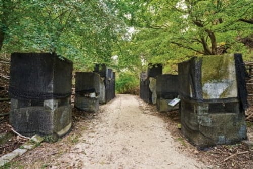
- Anti-tank Obstacles: The anti-tank obstacles are military installations that block advancing tanks. In emergencies, concrete blocks are dislodged to block the road. This road, created by the US Army Engineering Corps during the Korean War, served for evacuations from Yangju and Paju, Gyeonggi-do, and as an accessway to Seoul.
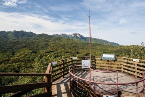
- Obong Observatory: This is the highest point of Uiryeong-gil, offering the most breathtaking views of Dobongsan’s peaks.
Course 9: Bukhansan Dulle-gil: Gureum Jeongwon-gil
This trail is also an easy option that offers stunning views of Bukhansan’s peaks, including Jokduribong, at the summit. If you’re short on time, this trail is worth considering.
General information
- Route: Northern Bukhansan Ecological Park → Haneul Observatory → Gijachon Observatory → Jingwan Ecological Bridge (Tomb of Prince Hwaui)
- Total travel distance: 5 km
- Average travel time: 2 hours
- Difficulty: Easy
- Transportation: Exit Bulgwang Station, Seoul Metro Line 3, at Exit 2 and turn left. Walk along Jinheung-ro for about 15 minutes until you reach the entrance to Gureumjeongwon-gil Trail.
Main spots
- Haneul Observatory: From this observatory, you can see the blue skies above, the lush green woods below, and the bustling metropolis of Seoul below.
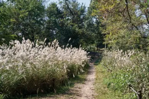
- Gijachon Observatory: This spot offers some of the best scenery along Section 8 of the Bukhansan Dulle-gil Trail. Midway along the deck, you’ll find a small field of silver grass, providing a perfect opportunity to take in both the natural beauty and the city below.
Course 10: Bukhansan Dulle-gil: Banghakdong-gil
If you want a relaxing trail, this is the one. It starts at Musugol, where Seoul’s only remaining rice paddies are found, and ends at the royal tombs. With gentle slopes throughout, it’s perfect for a leisurely walk. Plus, you’ll be surrounded by evergreen pine trees along the entire Banghakdong-gil trail.
General information
- Route: Musugol → Ssangdungi Observatory → Tomb of Princess Jeongui and Ahn Maeng-dam
- Total travel distance: 3.1km
- Average travel time: 1 hour 10 minutes
- Difficulty: Easy
- Transportation: To get to the start of Banghakdong-gil at Seilgyo Bridge in Musugol, walk for about 20 minutes from Exit 2 of Dobong Station, Seoul Metro Line 1. Alternatively, you can take Dobong shuttle bus No. 08 from Chang-dong or Banghak Station, Seoul Metro Line 1, and get off at the entrance of Musugol.
Main spots
- Musugol: This is an area where the trees lining the paddies and fields create a picturesque scene. Additionally, you’ll find cafes and camping grounds here for hikers looking to spend the night in the valley.
- Ssangdungi Observatory: This is the best view along Banghakdong-gil. Here, you can take in the picturesque peaks of Dobongsan and Bukhansan, including Jaunbong (summit), Sinseondae, Manjangbong, Seoninbong, Kalbawi, and Byeongpungbawi.
When is the Best Time to Visit Bukhansan National Park?
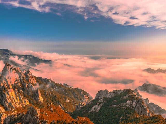
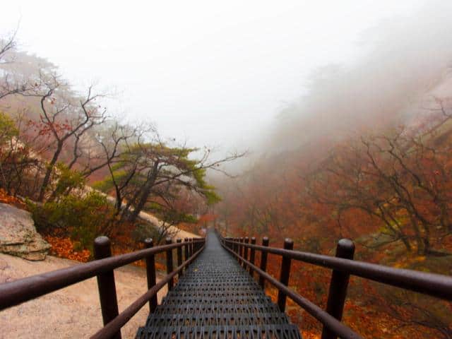
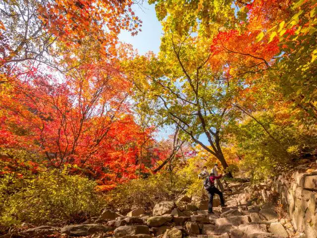
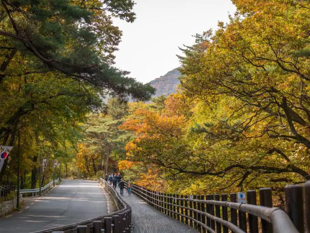
If you’re considering heading to Bukhansan National Park, spring and autumn are your go-to seasons for the best experience. From September to November, autumn brings cool weather and a vibrant display of red, orange, and yellow foliage, making the landscape absolutely stunning. Spring brings mild temperatures and vibrant blossoms from April to June, making it perfect for hiking and experiencing the park’s natural beauty in full bloom.


Starbucks The Bukhansan Branch
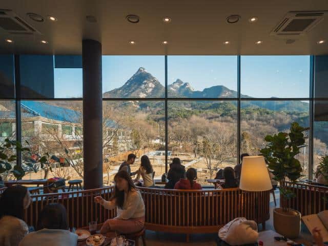
- Address: 277-11 Jingwan-dong, Eunpyeong-gu, Seoul
- Opening hours: Mon.-Fri. 8:00 – 21:00 | Sat. Sun. 7:00 – 21:00
- Tel.: 1522-3232
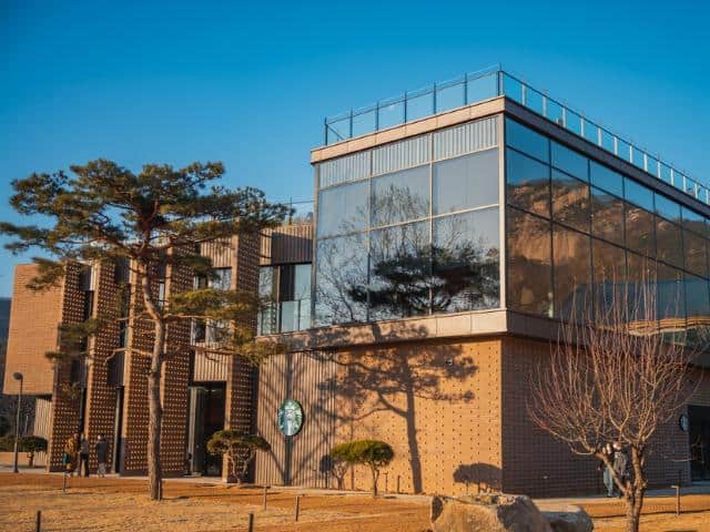
Starbucks The Bukhansan Branch is a cozy spot where coffee lovers can also enjoy the great outdoors. With a stunning view of the peaks through its big windows, it’s like a nature getaway without leaving your seat. The fresh air and coffee aroma make for a perfect break from city life.
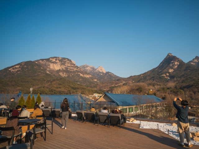
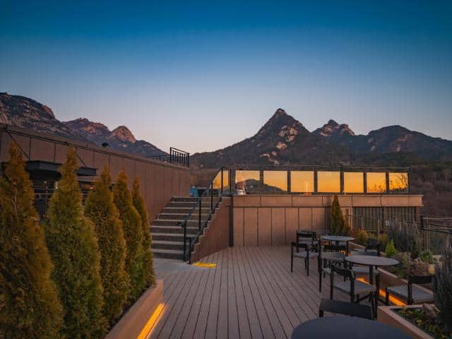
Upstairs at Starbucks Bukhansan, it’s all about the view. The deck up top is a prime spot to feel like you’re amongst the mountains. It’s an easy way to soak up the changing seasons—from the fresh green of spring to the winter snows—all while enjoying your coffee. This isn’t just a quick coffee run; it’s a little escape into nature, blending warm drinks with the beauty of South Korea’s landscapes.
Tips for a pleasant trip to Bukhansan National Park
- Choose the right time to go. Spring and fall are the best times to visit Bukhansan National Park. The weather is mild, and the scenery is beautiful.
- Pick a trail that’s right for you. Bukhansan National Park has trails for all levels of hikers, from beginner to experienced. Be sure to choose a trail appropriate for your fitness level and experience.
- Get the right gear. Wear sturdy shoes or hiking boots, and bring comfortable, moisture-wicking clothing. You’ll also want to bring a hat, sunscreen, sunglasses, and insect repellent.
- Bring plenty of water and snacks to stay hydrated and energized during your hike. The park has limited facilities, so it’s best to be prepared.
- Any information center within the park can give you a helpful leaflet with Bukhansan National Park’s trail map and recommended routes.
Popular Attractions Near Bukhansan National Park
Eunpyeong Hanok Village
- Address: 127-25 Jingwan-dong, Eunpyeong-gu, Seoul
- Open hours: 24/7
- Contact: +82 2-351-8523
If you’re seeking a glimpse into the rich heritage of traditional Korean architecture, look no further than Eunpyeong Hanok Village. Situated at the foot of Bukhansan Mountain, this village exudes the charm of hanok buildings, reflecting centuries of architectural wisdom.
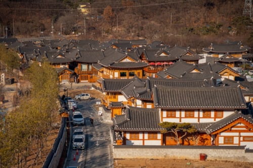
Unlike other hanok villages in bustling city centers, Eunpyeong Hanok Village offers a tranquil retreat amidst nature, where you can leisurely wander through Hanok-style cafes and shops. For a true immersion in Korean culture and aesthetics, a visit to Eunpyeong Hanok Village is a must.
419 Café Street 419카페거리
- Address: 568-53 Suyu-dong, Gangbuk-gu, Seoul
Named after the nearby April 19th National Cemetery, it combines modern coffee culture with historical significance. The street is full of trendy cafes, perfect for grabbing a coffee after a hike. Whether you prefer well-known chains or unique local spots, you’ll find something to satisfy your caffeine craving.
In conclusion, Bukhansan National Park is a treasure trove of natural beauty and cultural heritage. We hope this guide has equipped you with all the information you need to make the most of your visit. Now, Bukhansan National Park is calling – are you ready to answer?
You may also like:
- 10 Best Hidden Places in Seoul
- Best 10 Autumn Foliage Places to Visit
- All the Highlights: Best Things to Do in Seoul